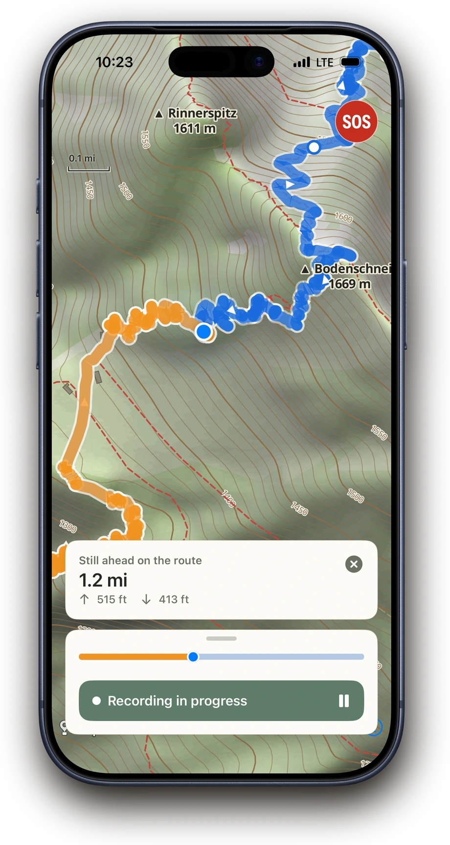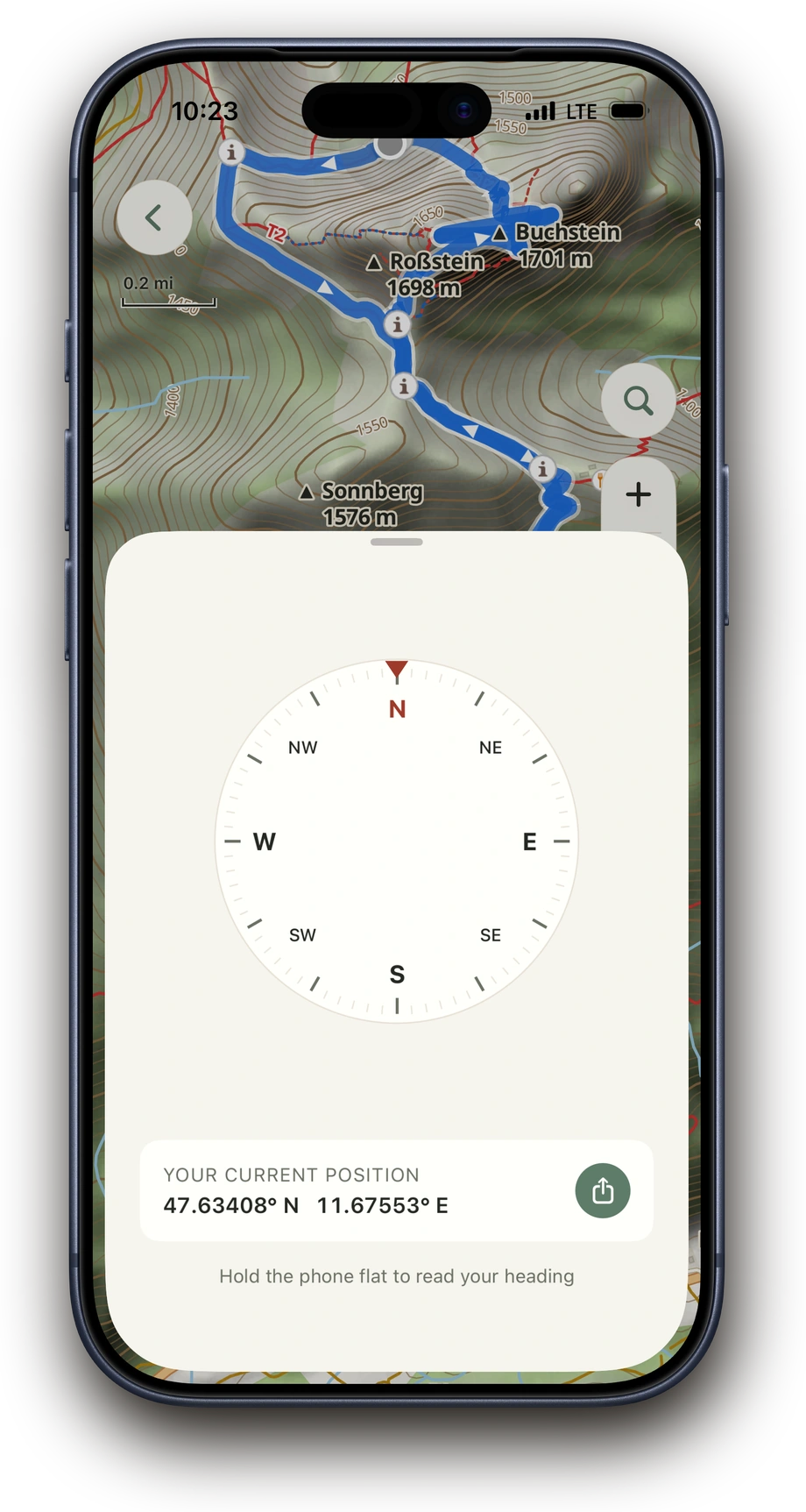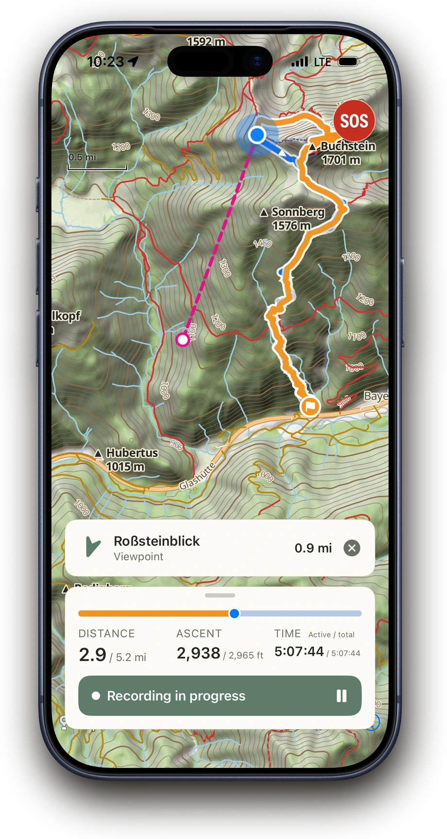
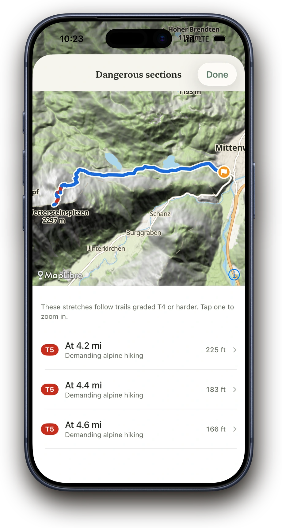
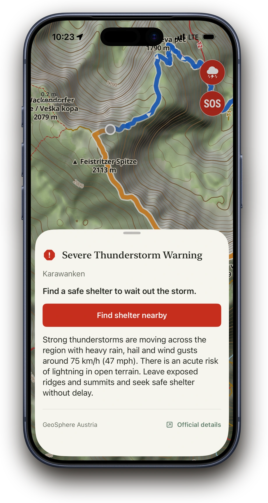
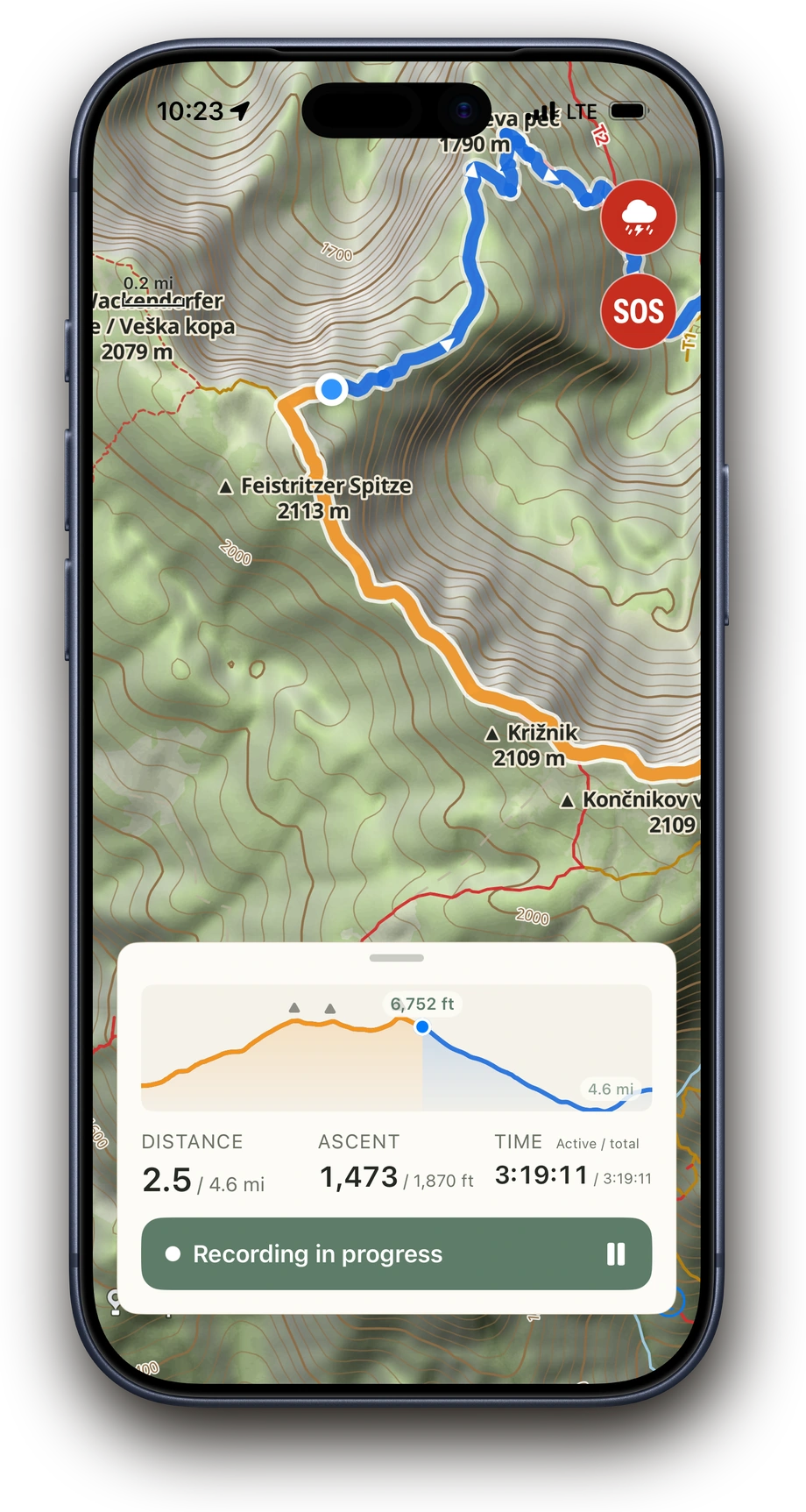
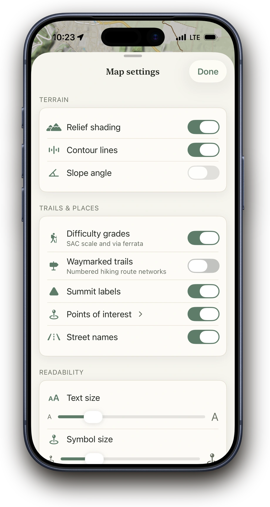
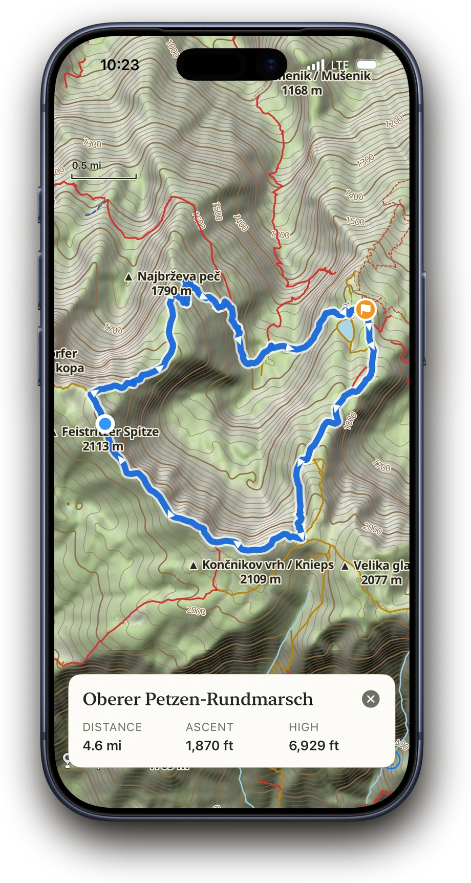
Map & terrain
Before, during and after your hike, Above shows a high-resolution topographic map with worldwide map data and useful overlays. You can read contour lines, relief, slope angle, paths including difficulty grades, summits, places, roads, lakes and rivers.
- Topo map with terrain and contour lines
- Relief, slope angle and summit names
- Hiking networks and difficulty grades of hiking trails
- Toggle map overlays during the hike too