Skip to content
Above
Above

Everything for hiking, in one place.

Record your tours, collect your summits, and carry the map offline. No feed, no user account, no social network.

A recorded tour in Above with stats and a memory photo
Above recording a hike: orange track behind, blue ahead, a position dot on the trail and the elevation profile open at 4.2 of 8.4 km
Download on the App Store Free download. No subscription.

Above has three areas that belong together.

Your planned tours and the archive of hikes you completed, your automatic summit book and a detailed hiking map for the trail.

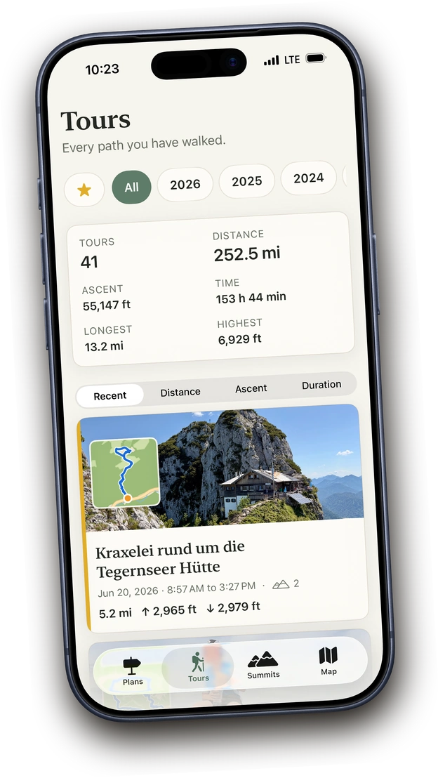
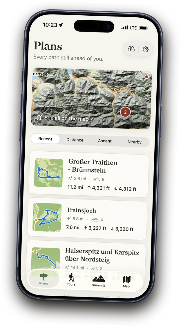
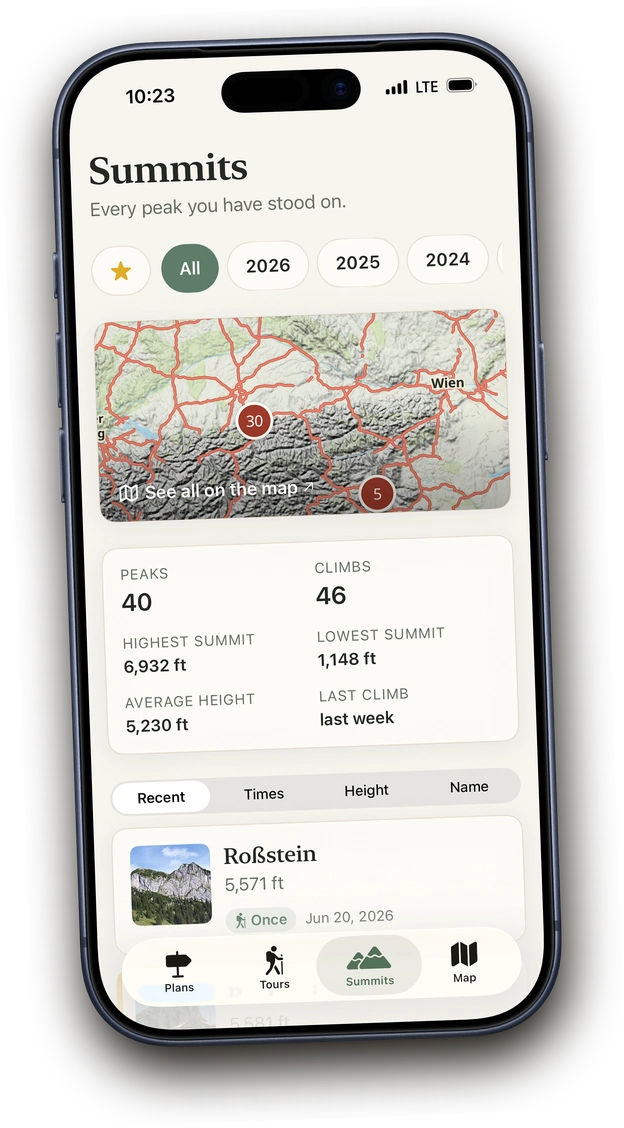
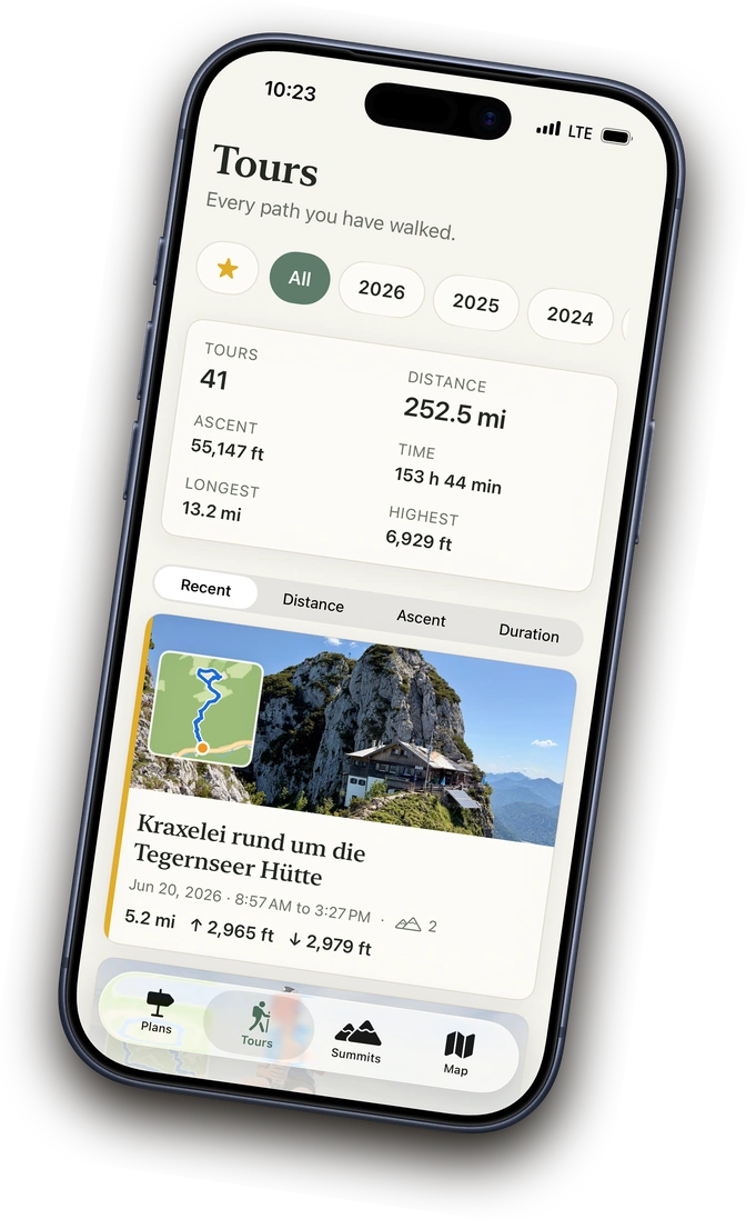
Your tour archive and planned tours

Before the hike and after.

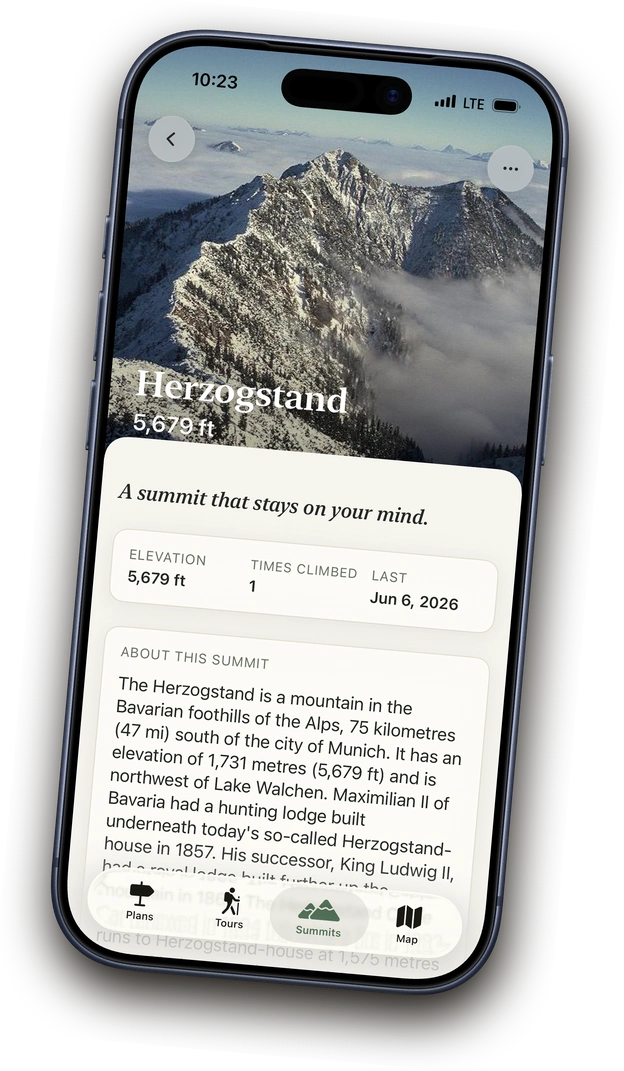
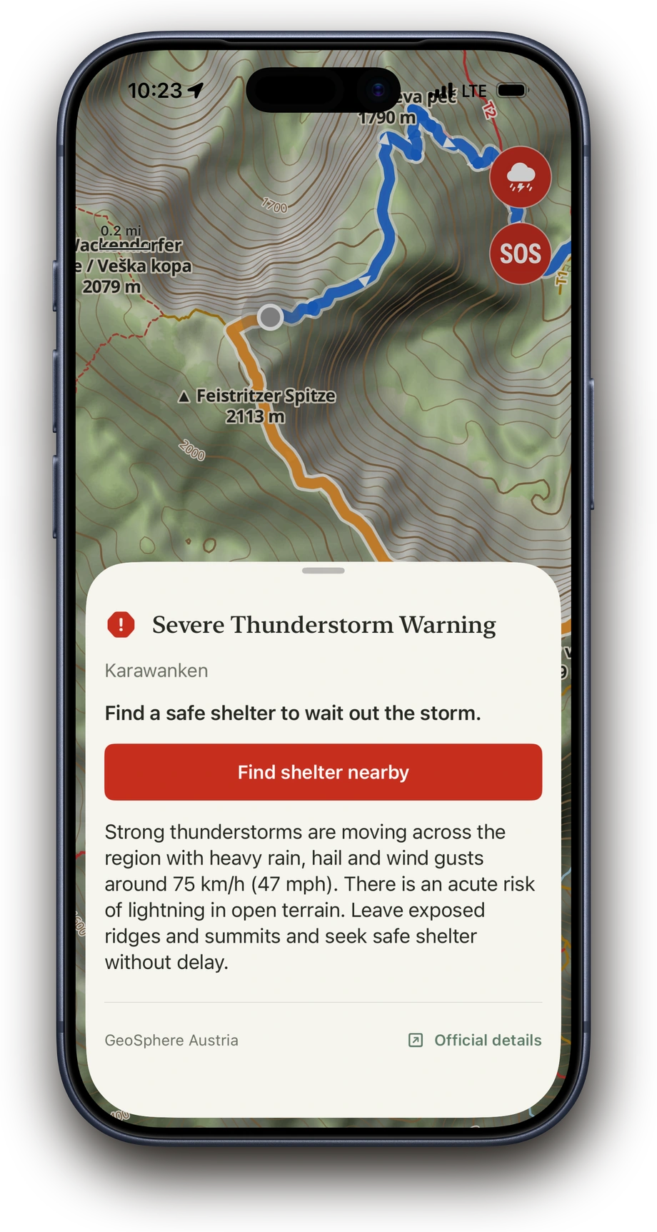
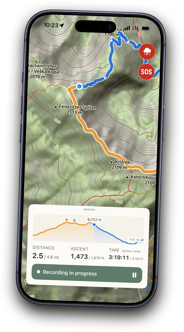
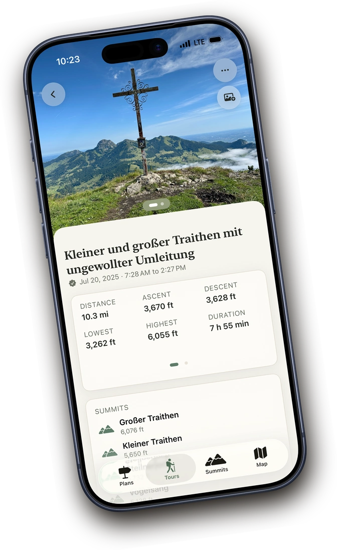
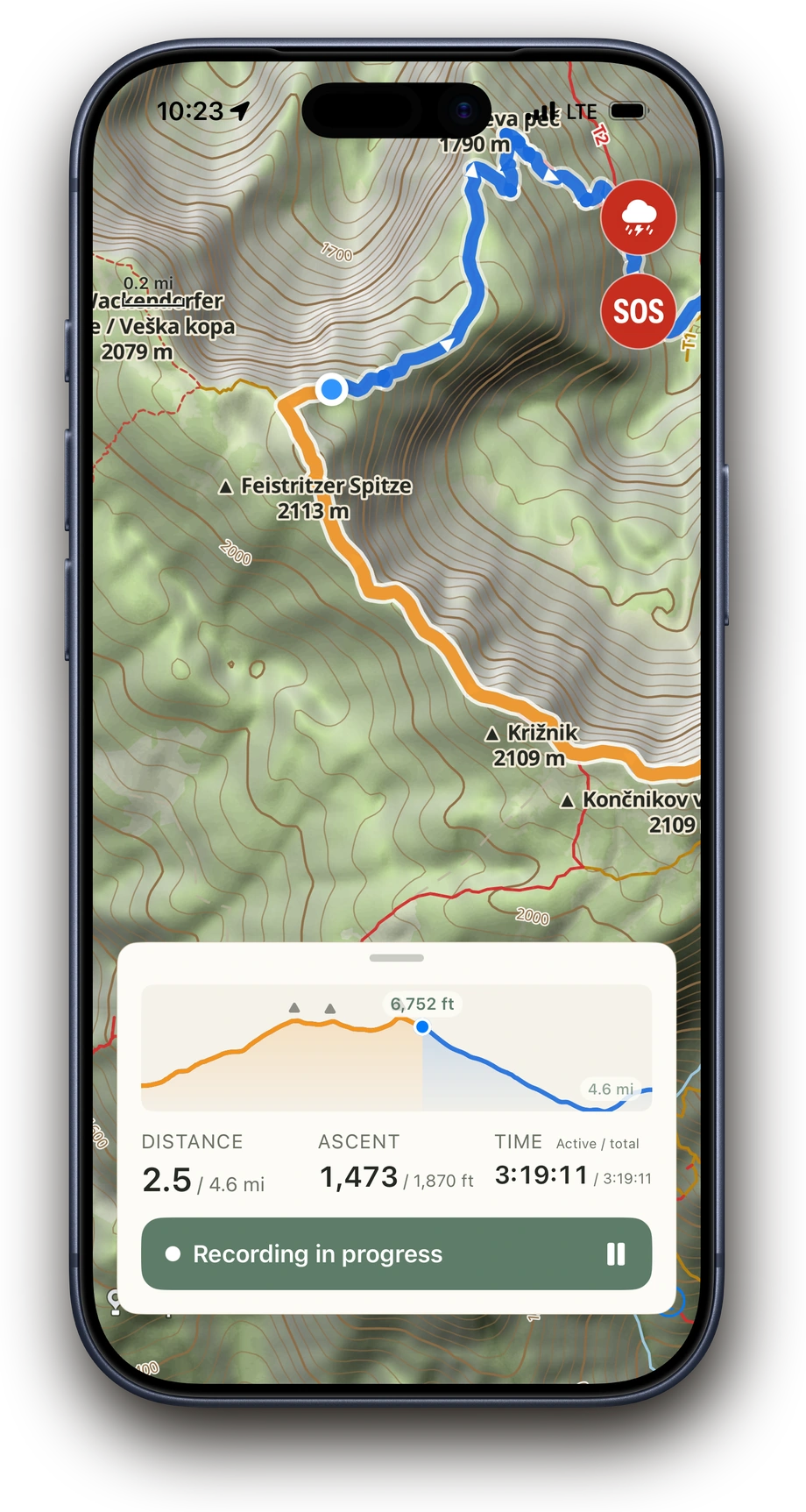
Above keeps planned tours and completed hikes in one place. Every tour carries its route, memory photos, notes and waypoints. Search, filters, favourites and stats help you keep track.

Learn more
A recorded tour in Above with stats and a memory photo
Planned tours in Above on the map with route pins

The summit book

Grows with every hike.

It grows on its own. Above recognises the summits from every tour, whether recorded in Above or imported, and files them with stats, notes and favourites.

Learn more
The summit book in Above, sorted by elevation

The hiking map

A tool made for the trail.

Bring planned tours from other apps or as GPX, prepared offline. Hand the start point to your nav, drive there, set off, with a high-resolution map, POIs, difficulty, bearing and warnings.

Learn more
Above showing an en-route severe-weather warning on the map
Above recording a hike: orange track behind, blue ahead, a position dot on the trail and the elevation profile open at 4.2 of 8.4 km

Good to know.

One-time purchase

Buy once, no subscription. Then Above is yours forever.

Worldwide

Detailed topo maps worldwide, weather warnings where available.

Private

No feed, no likes, no public profile. Your tours belong to you.

Safely recorded

Your active tour stays saved, even if you accidentally close Above during a hike.

Battery-friendly

Optimised for minimal power use, ideal for longer tours too.

Multi-day tours

Record longer tours across several days too.

Your summits, collected automatically.

After every tour, you see which summits you reached: with date, elevation, ascents and your stats. No listkeeping, no manual catch-up.

Sorted by elevation

Feistritzer Spitze 2,113 m 20 Jun
Herzogstand 1,731 m 14 Jun
Roßstein 1,698 m 8 Jun

46 ascents · 40 summits · highest summit 2,113 m

Above needs no user account. Your tours, summits, photos and notes live on your iPhone and, if you want, in your own private iCloud.

You can export every tour as GPX anytime, individually or as a full archive. Share completed hikes with friends as an image with a photo, route and tour details. Above itself is not a social network, and your data belongs to you, not a corporation.

No adsNo ad trackingNo user account requiredNo lock-in

Read the privacy policy

Bring a route. Then go.

Import a tour from Komoot, Bergfex, Outdooractive, an alpine club or any website as GPX. Above files it with your planned tours, prepares the topo map offline and sends you to the start point by navigation.

Take Above on the next hike.

Download on the App Store

Free download 3 recordings included, then one-time purchase. No subscription.