Skip to content
Above
← Back to overview

Above

Your hiking map for the trail

Navigate and record along the way.

Out in the terrain, seeing only your location is not enough. You want to know where your route goes next, how far you have already come and which sections ahead may be difficult. Above's hiking map shows you not only the path, elevation profile and terrain, but also important places along your route. It is automatically prepared for offline use before your hike, so you can see everything important even without reception.

Download on the App Store Works offline · No user account · No subscription
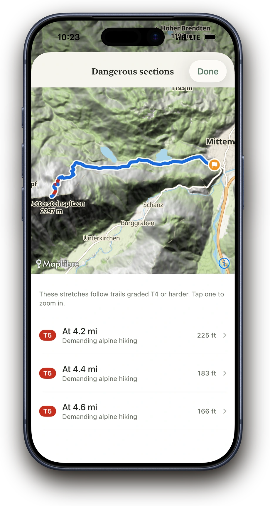
Difficult or exposed sections of a planned tour in Above
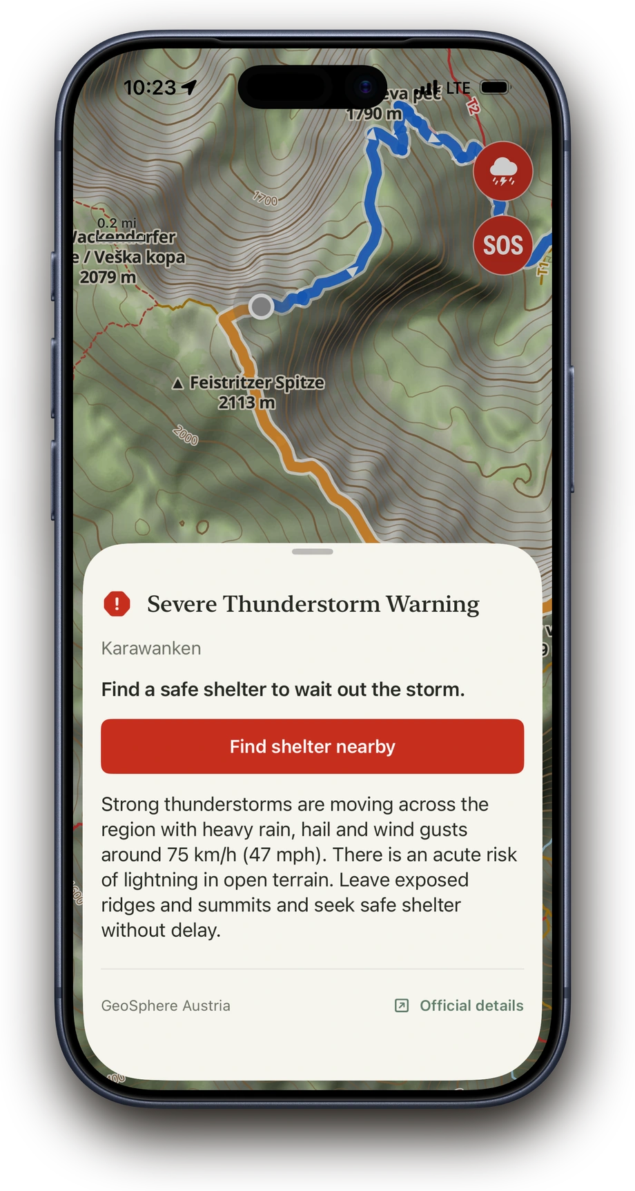
Above showing an en-route severe-weather warning on the map
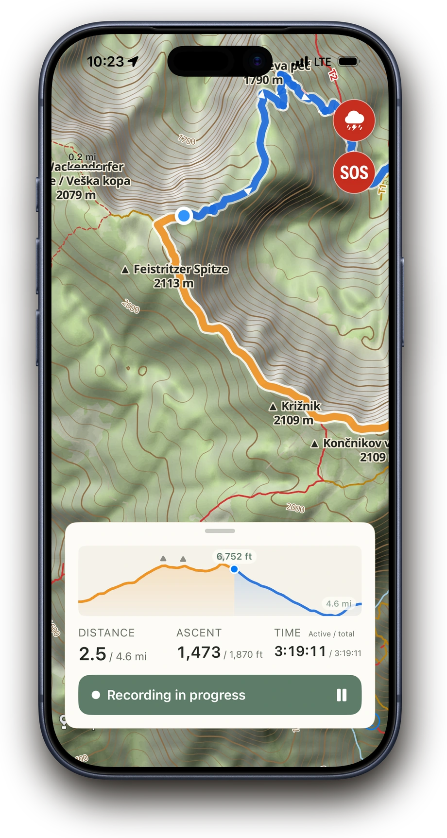
Above recording a hike: orange track behind, blue ahead, a position dot on the trail and the elevation profile open at 4.2 of 8.4 km
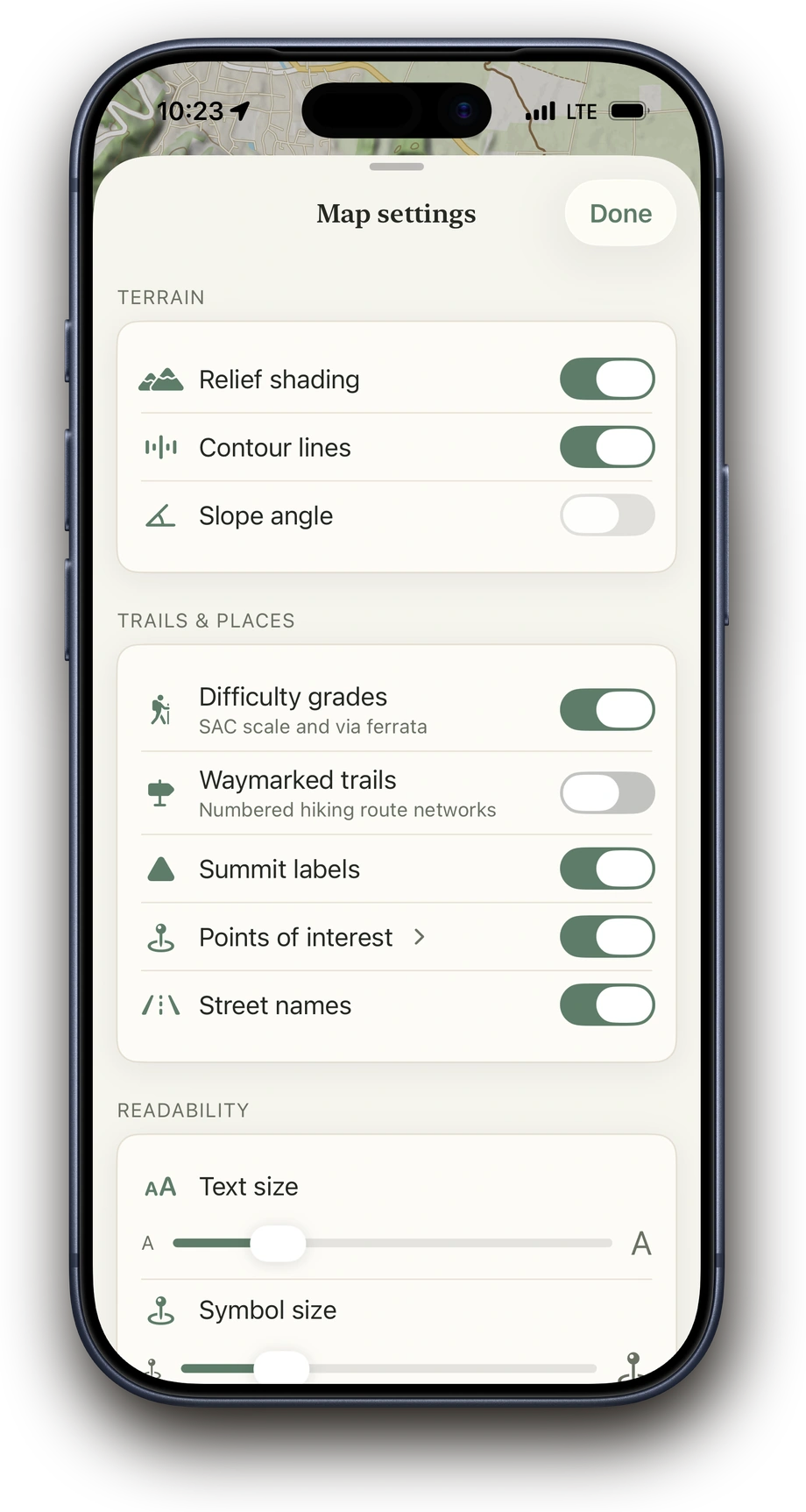
Map settings in Above: layers and overlays
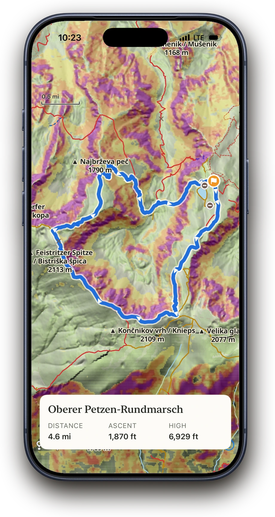
Oberer Petzen loop on the Above map with the slope-angle layer enabled

Map & terrain

A path on a map tells you little about what to expect out on the trail. On Above's detailed, easy-to-read maps, you can spot climbs, slopes and landmarks in advance. This helps you understand how your route runs through the terrain and which sections may be demanding.

  • Topo map with terrain and contour lines
  • Relief, slope angle and summit names
  • Hiking networks and difficulty grades of hiking trails
  • Toggle map overlays during the hike too
Above recording a hike: orange track behind, blue ahead, a position dot on the trail and the elevation profile open at 4.2 of 8.4 km
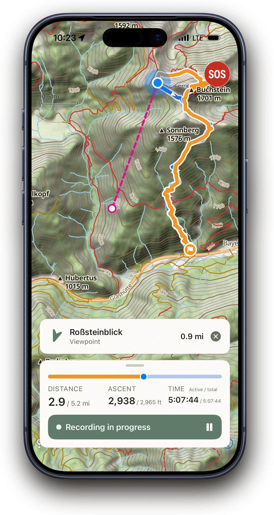
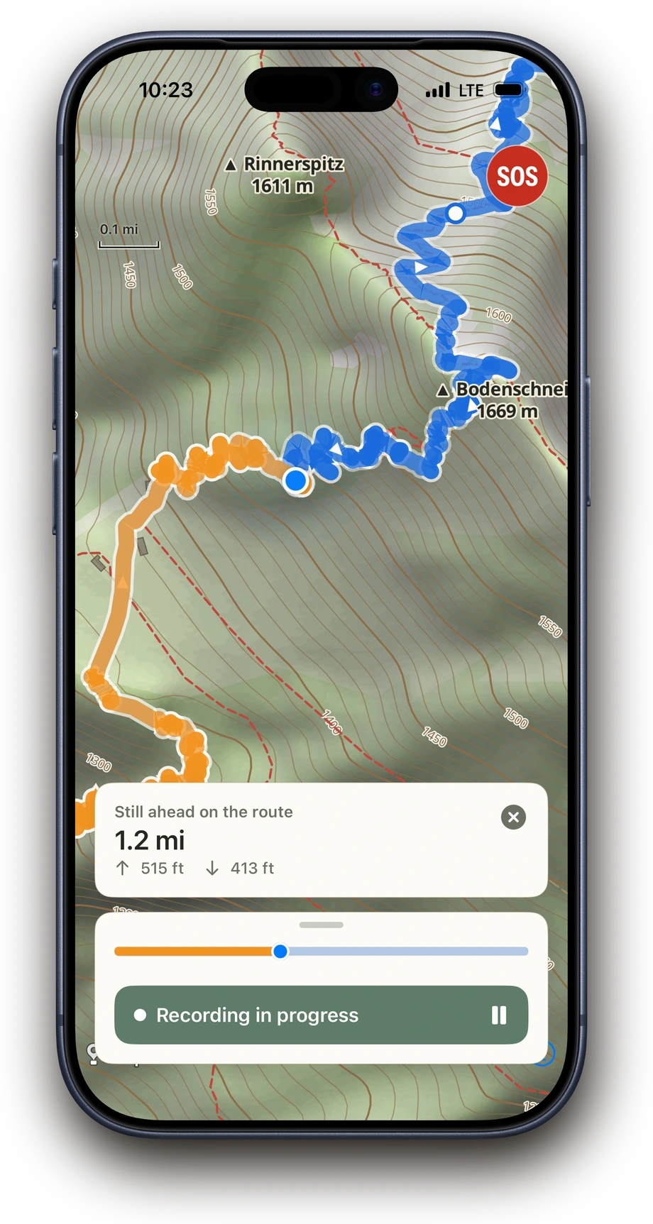
Above showing distance and elevation to a point ahead on the route

Your tour on the map

Out on the trail, you want to know not only where you are, but also how much distance and elevation still lie ahead. Above shows your planned route, the path you have already covered and your current position directly on the map. Tap any point along the route to see how far away it is and how much elevation remains.

  • Current position and planned route on the map
  • The path you have covered directly in the recording
  • Distance, ascent, time and auto-pause
  • Interactive elevation profile
  • Distance and elevation to every point along the route
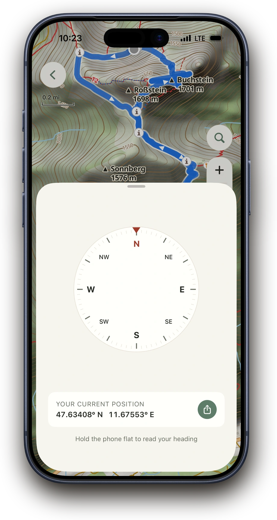
Above map with compass and your position while hiking
Above map with an active bearing to the Roßstein summit, 362 m away, while recording

Search & navigate

Sometimes you want to know where to find the nearest hut, a water source or a particular summit while you are out on the trail. Search lets you find places directly on the map, even offline within your tour's area. For a spontaneous detour, Above can show direction and distance or calculate a route to the selected point. Your planned route remains unchanged. If you stray from the calculated route, it is not recalculated automatically.

  • Find huts, water sources, cable cars, parking and other places, even offline within your tour's area
  • Show direction and distance with a bearing or calculate a route to any point on the map
  • Compass directly on the map when you are out without a route
  • View opening hours, phone numbers and websites for places, when available
Difficult or exposed sections of a planned tour in Above
Above showing an en-route severe-weather warning on the map

When it matters

Conditions can change quickly while you are out on the trail. Above alerts you to difficult or exposed sections, shows official severe-weather warnings, warns about known access restrictions and protected areas, and lets you know when you stray from your planned route. In an emergency, you can call for help directly and share your current location.

  • Spot difficult or exposed sections in advance
  • Severe-weather warnings before the start and on the trail
  • Known access restrictions and protected areas, already while planning
  • Alert when you leave your planned route
  • SOS with current location and regional emergency numbers

Ready before reception disappears.

Above downloads the topographic map, including trails, terrain information and important places, across a wide area around your route completely to your iPhone. This lets you navigate even on unplanned detours without cellular reception and calculate routes to any point.

Good to know.

Official severe-weather warnings

Above shows official warnings from DWD, GeoSphere Austria and Apple WeatherKit, where available, before and during your hike.

Proven map data

Above prepares OpenStreetMap data as a topographic hiking map and updates it monthly. In Switzerland, you can also use official swisstopo maps.

Resume your recording

If you accidentally close Above during an active recording, you can resume it afterwards.

No planned route needed

You can head out without a planned route, start recording and then save your hike to the tour archive.

Take Above on your next hike.

Download on the App Store

Planning and archive always free. Try recording 3 times, then unlock once.

← Back to overview